

Knockatee [Cnoc an tSi]
Good walks are even better shared.
Overview
Knockatee [Cnoc an tSi]
Nestled amidst the scenic expanse of Fermanagh and Omagh, Knockatee stands as a Marilyn at 483 meters, offering walkers a delightful experience under the rays of the Irish sun (or a fine drizzle, depending on your luck!).
Geology
The mountain's geological foundation consists mainly of sandstone, which has weathered over time to create varied and engaging terrain. Enjoyable for both seasoned hikers and those dipping their toes into mountain wandering, this terrain provides reliable footing.
Routes
One of the most favoured routes starts from the Ballyconnell Road. At about 3.5 km in length and taking around 1.5 hours, it’s perfect for a breezy hike. The gradual ascent will transport you through a tapestry of lush greenery and blooming heathers.
Summit Features
At the summit, expect to see a friendly cairn beckoning you for a quick photo op, enhancing your accomplishment along with some panoramic views.
Views
Once you reach the top, prepare for a feast of views! On a clear day, it’s possible to catch sight of Lough Erne and explore the undulating hills that seem to stretch endlessly. Spring and early summer are particularly stunning, as the surrounding flora bursts into life, offering a delightful palette of colours.
Hazards
Always stay prepared! While the trails are well-trodden, watch out for wet spots after a rain shower, and be mindful of fog which can creep in swiftly across the landscape—keeping an eye on the weather is key!
Nearby Summits
Adjacent to Knockatee is the slightly taller Lough Navar Forest, which can provide additional hiking options for the adventurous soul.
Access
Getting there is straightforward, with a small parking area along the Ballyconnell Road. Local bus services are available from nearby towns, but ensure to check timings in advance to avoid a long wait.
Facilities
Just a stone’s throw away in Derrygonnelly, you'll find a charming tea shop perfect for refuelling either side of your hike—because everyone deserves a good cup of tea!
History
The name Knockatee translates to 'Hill of the Fairy,' and if you believe the local stories, who knows what magical visitors you may encounter on your adventures? This hill is not just a treat for hikers but also a place woven into the fabric of Irish mythology.
So, gear up for an enjoyable outing at Knockatee, where the hills are rolling, the views are stunning, and the legends... well, they might just be true!
Explore routes near Knockatee [Cnoc an tSi]
Public walks starting within 80 km of this hill. Nearby does not mean a route reaches the summit; check its map and access before setting out.
No public routes are currently listed within 80 km of Knockatee [Cnoc an tSi] on Walkmates. This does not mean there are no paths here. Explore the map and check local access information before planning a walk.
Route planning notes
These notes describe possible approaches, not verified navigable routes or permission to cross land. Check current paths, local access rules and conditions before setting out.
Ballyconnell Road Route
An easy ascent starting from Ballyconnell Road, passing through lush greenery and gradually leading up to the summit.
Make a day of it, together
Find someone to share the walk with, or organise a day out along a route you like.
Photo Gallery
View all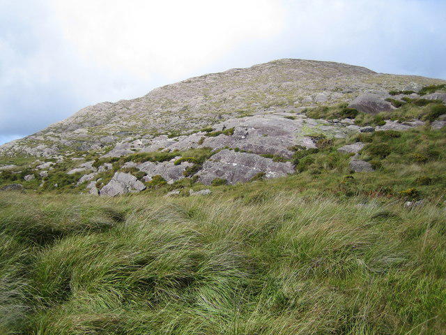 Photo could not load
V7760 : Knockatee
Nigel Cox
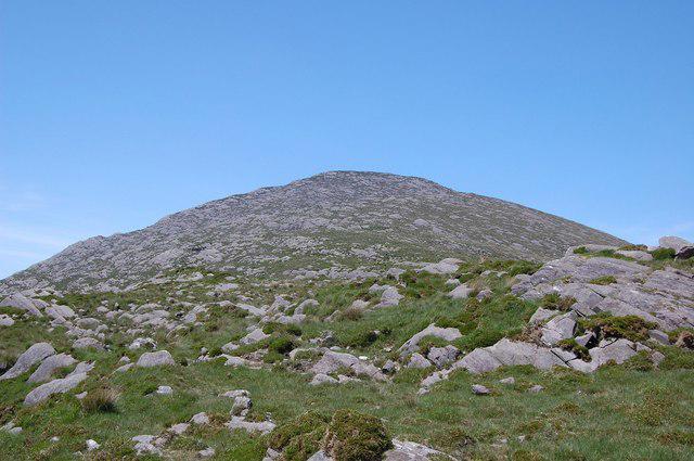 Photo could not load
V7760 : The summit of Knockatee
Trevor Harris
Hill facts and local notes
Classifications
Elevation
330m
1,083 ft
Prominence
176m
Coordinates
51.7831, -9.7758
V775604
OS Map
84
At the Summit
The summit is marked by a modest cairn, perfect for a quick photo-op while enjoying a well-earned snack.
Terrain & Geology
The summit is primarily composed of sandstone, forming a stable base that is generally solid underfoot. The surrounding area features interesting weathered rock formations, adding to the scenic beauty.
Views & Scenery
On a clear day, you can see the stunning Lough Erne to the south and the rolling hills stretching into the distance. Don't forget to play spot the sheep!
History & Heritage
Name Origin
Cnoc an tSi translates to 'Hill of the Fairy,' rich in local folklore suggesting magical inhabitants.
Historical Significance
Knockatee has historical significance with links to ancient Irish mythology, making it a cherished spot for cultural heritage.
Getting There & Facilities
Check current local access restrictions, parking rules and transport timetables before travelling. These notes do not confirm public access to the summit.
Parking
There is a small designated parking area at the start of Ballyconnell Road, with space for a handful of vehicles. Arrive early to secure a spot!
Public Transport
Local buses connect nearby towns, but it's advisable to check schedules as service can be sparse—hitching a ride may be your best bet!
Nearby Facilities
A quaint tea shop in Derrygonnelly offers refreshments and restrooms. Perfect for a pre-hike cuppa or a post-hike treat!
Safety Information
Known Hazards
- While the routes are generally safe, be cautious of wet and muddy patches, especially after rain. Fog can also roll in quickly, reducing visibility.
General Safety Tips
- Check weather conditions before setting out
- Carry appropriate clothing and equipment
- Let someone know your planned route
- Take a map, compass, and GPS device
- Carry emergency supplies: food, water, first aid kit, torch
Hills
Some common questions about the hills answered
Are there group walks up Knockatee [Cnoc an tSi]?
Many walkers use Walkmates to join or organise walks with others. You can check for group walks around Knockatee [Cnoc an tSi] through the maps
Are there other walkers around Knockatee [Cnoc an tSi]?
Activity varies by location and time, but Walkmates lets you see whether others have shared walks or shown interest in this area. Find other people through the walking friends search walking friends for Knockatee [Cnoc an tSi] search or of course create your own walk for Knockatee [Cnoc an tSi]
Can I organise a walk to Knockatee [Cnoc an tSi]?
Yes. If there aren’t any walks listed already, you can create a walk and make it available for others to join.
If you're signed up to Walkmates, you can create a walk to Knockatee [Cnoc an tSi].
How do I find a walk up this hill?
There are often multiple ways to walk this hill, depending on experience and route preference. Walkmates helps you explore walks and routes that others have shared.
Can I suggest a new route up Knockatee [Cnoc an tSi]?
Yes. You can suggest or create routes to share with others. Walkmates focuses on the social side of walking, so routes are used to help people organise walks and explore areas together, rather than as detailed navigation tools or route libraries.
Other uses really appreciate knowledgeable walkers sharing their routes. Share your favourite route to Knockatee [Cnoc an tSi] here
The is an error or something incorrect about this hill. How do I let you know?
We always strive to keep the information on Walkmates as accurate as possible. If you find an error, please let us know through the contact form and we'll aim to correct it as quickly as possible
Community Discussion
Comments
Location
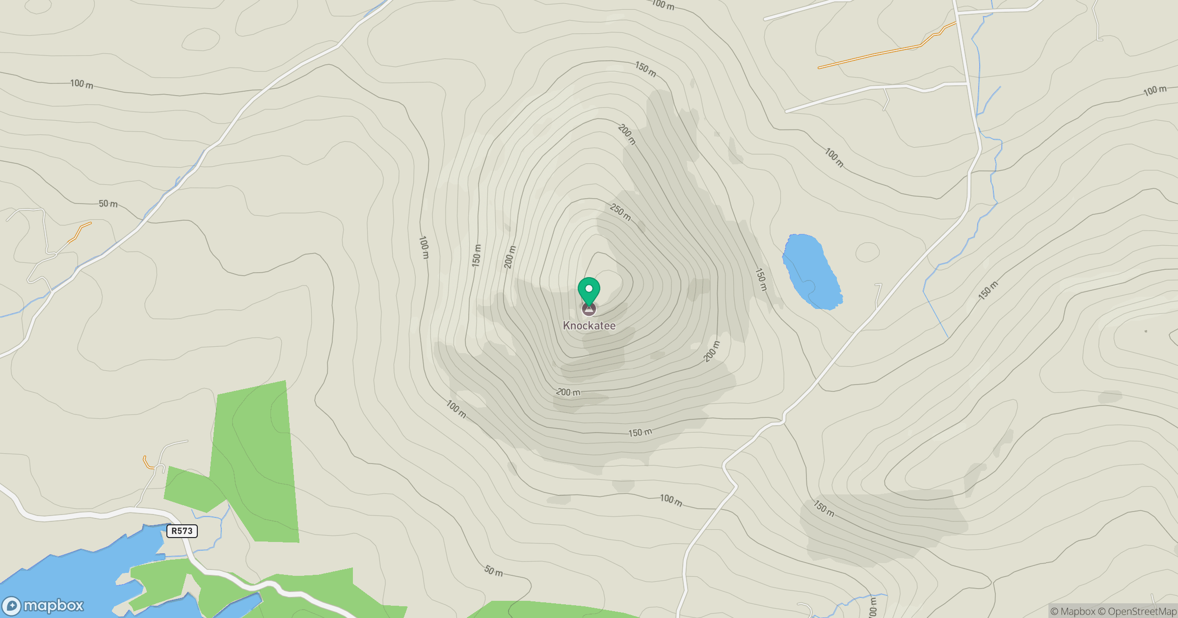
Grid reference: V775604
View on OpenStreetMapOpens a map in a new tab, centred on the hill.
Hills within 30 km
Straight-line distance, not a walking route or confirmation of access.
No comments yet. Be the first.